
Centre county Pennsylvania, USA | That makes sense to me, slope of terrain features seems to be changing flow sensor "calibration", somehow.
Attached combine attitude maps show error in terrain featured surface area as % of plane (flat) surface area for 3 different fields. First two show errors in 0.15% to 0.4% range, those are from our terrain featured fields and are typical of most fields here in terrain featured country. The third shows errors of 0.01%, that is from one of Don Larkin's flat(er) fields and is typical of many fields in mid west corn belt. Thanks for data file Don L.
 (JS-7 combine attitude map.jpg) (JS-7 combine attitude map.jpg)
 (JG-3 combine attitude map.jpg) (JG-3 combine attitude map.jpg)
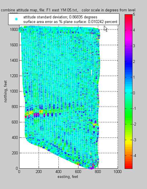 (F1-east combine attitude map.jpg) (F1-east combine attitude map.jpg)
Attachments
----------------
 JS-7 combine attitude map.jpg (49KB - 219 downloads) JS-7 combine attitude map.jpg (49KB - 219 downloads)
JG-3 combine attitude map.jpg (55KB - 196 downloads)
F1-east combine attitude map.jpg (52KB - 187 downloads)
|
 Combine attitude and Yield map color stripping

